


SHIELDS 241 Voting District, Lake County, Illinois
About
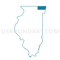
Outline

Summary
| Unique Area Identifier | 571984 |
| Name | SHIELDS 241 Voting District |
| County | Lake County |
| State | Illinois |
| Area (square miles) | 1.90 |
| Land Area (square miles) | 1.90 |
| Water Area (square miles) | 0.00 |
| % of Land Area | 100.00 |
| % of Water Area | 0.00 |
| Latitude of the Internal Point | 42.30030830 |
| Longtitude of the Internal Point | -87.86910460 |
Maps


Graphs
Select a template below for downloading or customizing gragh for SHIELDS 241 Voting District, Lake County, Illinois


Neighbors
Neighoring Voting District (by Name) Neighboring Voting District on the Map
- LIBERTYVILLE 164 Voting District, Lake County, IL
- LIBERTYVILLE 166 Voting District, Lake County, IL
- LIBERTYVILLE 167 Voting District, Lake County, IL
- SHIELDS 235 Voting District, Lake County, IL
- SHIELDS 238 Voting District, Lake County, IL
- SHIELDS 239 Voting District, Lake County, IL
- SHIELDS 242 Voting District, Lake County, IL
- SHIELDS 243 Voting District, Lake County, IL
- SHIELDS 244 Voting District, Lake County, IL
Top 10 Neighboring County Subdivision (by Population) Neighboring County Subdivision on the Map
Top 10 Neighboring Place (by Population) Neighboring Place on the Map
Top 10 Neighboring Elementary School District (by Population) Neighboring Elementary School District on the Map
Top 10 Neighboring Secondary School District (by Population) Neighboring Secondary School District on the Map
- Libertyville Community High School District 128, IL (49,926)
- Lake Forest Community High School District 115, IL (28,251)
Top 10 Neighboring Unified School District (by Population) Neighboring Unified School District on the Map
Top 10 Neighboring State Legislative District Lower Chamber (by Population) Neighboring State Legislative District Lower Chamber on the Map
- State House District 59, IL (112,327)
- State House District 60, IL (101,630)
- State House District 58, IL (101,562)
Top 10 Neighboring State Legislative District Upper Chamber (by Population) Neighboring State Legislative District Upper Chamber on the Map
Top 10 Neighboring 111th Congressional District (by Population) Neighboring 111th Congressional District on the Map
Top 10 Neighboring Census Tract (by Population) Neighboring Census Tract on the Map
- Census Tract 8632.02, Lake County, IL (5,093)
- Census Tract 8630.04, Lake County, IL (4,578)
- Census Tract 8630.05, Lake County, IL (4,407)
- Census Tract 8637.02, Lake County, IL (3,742)
- Census Tract 8636.01, Lake County, IL (3,555)
- Census Tract 8632.01, Lake County, IL (3,443)
- Census Tract 8630.06, Lake County, IL (0)